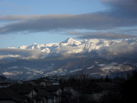
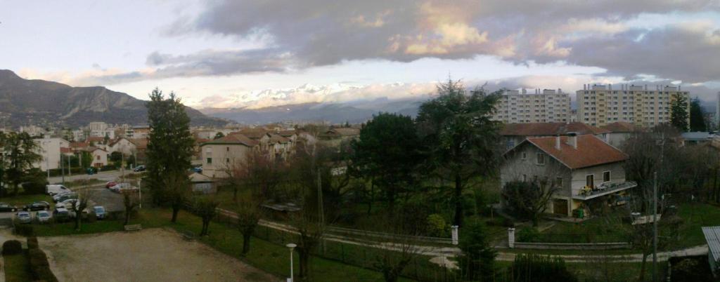
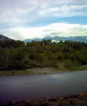
Evening over Fontaine, facing the Belledonne massif
Evening over Fontaine, facing the Belledonne massif
In 2004, and after spending about 20 years in the region, 17 years of which were in Fontaine, I realised that I knew essentially nothing about the community I lived in. Busy spending as much free time as possible either travelling around the region, especially the mountains, or around the world when I have the money, I have to admit that at first Fontaine itself was of no particular interest to me; I preferred neighbouring Sassenage, and if I was in Fontaine, it was for a couple of reasons, one of which was workplace proximity..
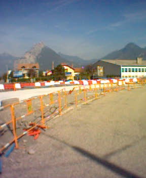
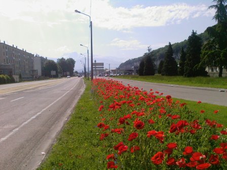
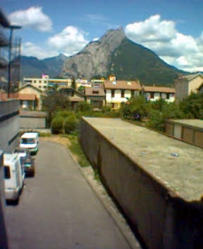
Boulevard Paul Langevin
Having said that if Fontaine was of no particular interest; there was no reason why it shouldn't have a page of its own on my travel website, seeing as how it was the starting point for many of them.
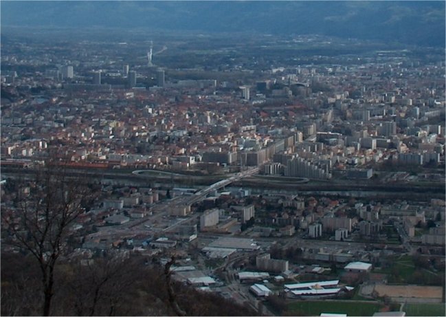
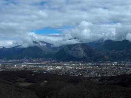
Grenoble at ± 9000 metres
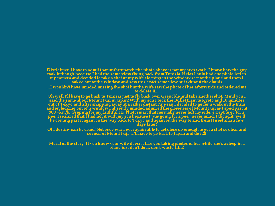
DisclaimerSo what and where is Fontaine?
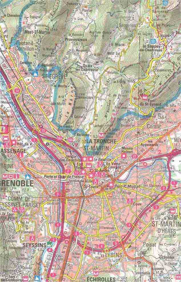
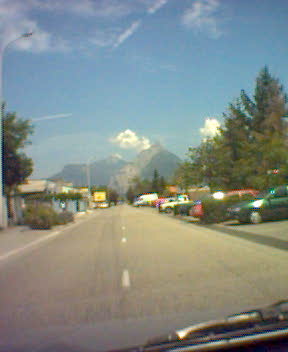
Fontaine lies to the west of Grenoble, capital of the French Alps, and is separated from it by the river Drac and the "Rocade Sud", Grenoble's peripheral jugular vein, as can be seen in the following map.
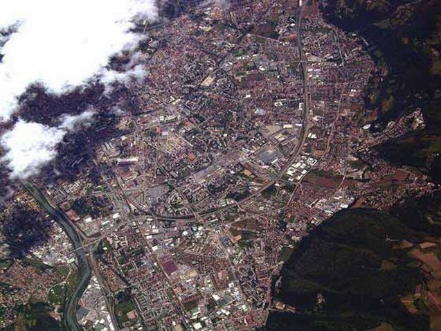
Nestled between the river Drac and the Vercors massif, Fontaine dates back, according to archaeological finds, some 15,000 years. The 21st century, however, sees Fontaine's physical expansion reaching its geographical, if not demographical, limit, and since I've been here I've seen fields of vegetables, old factories, tanneries and other small historical or traditional local crafts and industries (i.e., glove manufacturers) disappear to make way for housing complexes for Grenoble's overspill..
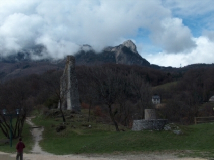
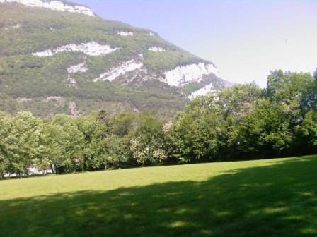
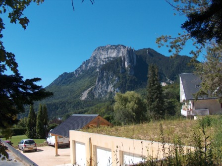
As far as the landscape is concerned, Fontaine lies just underneath the slate grey limestone cliffs of the Vercors massif, cliffs that rise, like jagged wooded steps, up to the 3 Pucelles (The 3 Maidens, in English), in turn overshadowed by the "Moucherotte" peak culminating some 1900 metres above sea level, a source of abundant pleasure for hitchhikers, mountain bikers, rock climbers, and Nordic skiers alike.
On the northeastern side of the valley, the Chartreuse massif provides a view of the typical sloping, forested valleys formed by glaciers, with occasional hillside clearings with houses and winding roads leading up to middle-mountain ski resorts at about 1000 meters in elevation within the Chartreuse National Park..
To the east and southeast lies the Belledonne massif, with its peaks culminating at around 3000 metres, and the Matheysin plateau * completes the panorama so that no matter which direction you drive back into Grenoble from, east, west, north or south, the view is always spectacular.* The Matheysin plateau (alt. 900 metres) merits a couple of words, notably because it is a refuge for many locals during Grenoble's hot, stuffy summer months. Famous for its "Napoleonic Route", the road Napoleon took coming back from exile on the Island of Elba in 1815, the plateau ultimately leads up into the Alps and possesses a number of lakes, vestiges of long-gone glaciers. Where once Napoleon met his army, today hordes of people, tourists and locals, your humble servant included, go swimming in summer, far away from the sweltering, muggy heat of Grenoble in the valley below.
Until the 1960s and 1970s, the Matheysin plateau had a separate identity from that of Grenoble. This was notably due to the difficulty accessing it; a flourishing local commerce and local industries, such as mining, meant that the inhabitants were self-sufficient and rarely if ever needed to go down to Grenoble. But the mines eventually closed, and the region became an annexe to Grenoble, offering a lifestyle for those ready to pay the price, brave the winter climate (biting easterly winds and temperatures as low as -20 Celsius), and drive the extra 30 minutes to Grenoble to work and shop in the outlying commercial zones.The late afternoon setting sun reflecting off the wintry snow-covered peaks of the Belledonne, turning from yellow to red and then to purple, is simply magnificent. The only thing I regret about the landscape, though, is that there are no lingering sunsets here because of all the surrounding mountains. This is probably why I enjoy them even more when I travel elsewhere.
Weather-wise, Fontaine is also quite particular. You can't really talk about "microclimate", but it does often happen that while it may be raining or foggy on one side of Grenoble, Fontaine can be dry and clear, and we are only talking about a matter of a kilometre's distance between the variations in weather! Once again the mountains, and notably the flanks of the Chartreuse massif, around which Grenoble and the river Isere* bend, play a major role here.
* Grenoble's two rivers, the Isere and the Drac, are themselves sources of localised variations in weather. Morning mist may often be swirling over the nearby suburban towns on one side of the river but not the other, and banks of fog sail down the middle of the river as if following the current.Above all, though, what I really love doing is climbing up to the "Tour sans Venin", at an altitude of around 800 metres, and watching the rain come down the little, wooded valleys of the Chartreuse on one side of the valley and the sun shining down on the woody slopes of Chamrousse and the Matheysin plateau on the other.
The "Tour sans Venin"Demography and an Englishman
Politically speaking, Fontaine is an autonomous, communist-run, suburban dormitory town to the west of Grenoble. Demographically speaking, it's a typical modern-day melting pot. Its ± 25,000 inhabitants are made up of French, North African, Spanish, Portuguese, Italian and Turkish families and at least 1 Englishman and his Kyrgyzstani-born wife.
The Rocade Sud
Grenoble's peripheral ring road is a story in itself and ever a source of heated debate. Initially built for the 1968 Winter Olympics, the Rocade Sud skirts the south and west of the Alpine capital, hemmed on all sides by the surrounding mountains and massifs, linking Grenoble to Lyon, Geneva, the Italian border, and, by torturous means, Nice and the Cote d'Azur to the southeast. Some 40 years after the 1968 games, Grenoble's ring road is saturating, and a planned northern half of the peripheral ring road1, sadly missing from Grenoble's traffic infrastructure, may never see the light of day. This leaves a slowly asphyxiating Grenoble to mull over one essential problem: risk being bypassed in favour of the Lyon-Chambery-Turin road/rail axis further north and seeing its economy stagnate or opening itself up, settling the problem of traffic/sup> and remaining a major actor in regional affairs.
1 The plan is to run a tunnel through the Chartreuse massif, opening up a northern access to the city, but nothing has been fixed, and work is not planned to start in the near future.
2 At the time of writing (Nov 2011), there was a project to widen the central part of the Rocade Sud from 4 to 6 lanes. Apparently, the project, if agreed upon, would see the light of day in 2015. In the meantime, the city fathers, on seeing that there is a problem with pollution, are limiting traffic speeds from 90 km/h to 70 km/h.
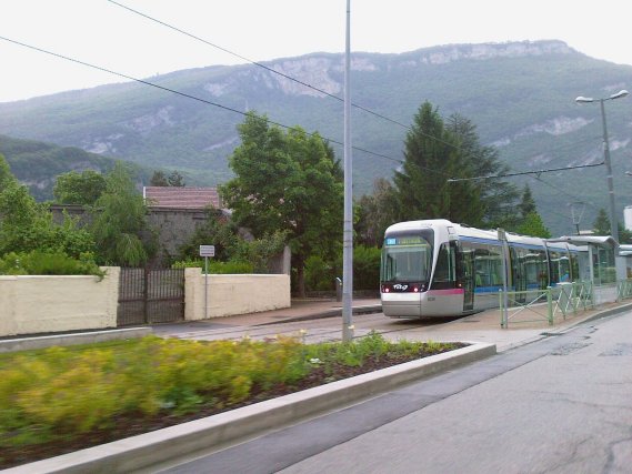
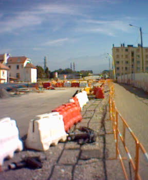
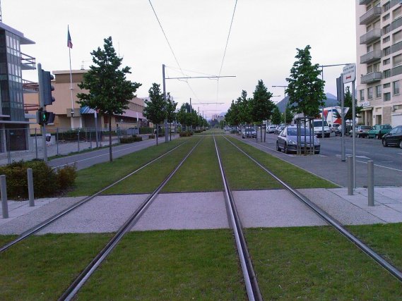
Concerning regional public transport. Since initially writing this page, in 2004, regional public transportation has developed considerably. A third tram line has been built (see photos of "Etoile" below) linking the northeast of the agglomeration to the city's campus, with an extension to the scientific research pole and to the agglomeration's northern suburbs underway, an extremely good idea for those needing to move around within city limits. However, for those simply trying to avoid the ever-increasing circulation on the city's peripheral "Rocade Sud" ring road, the problem remains.
NB. An anecdotal illustration of how reason finally triumphs. For years a hydroelectric dam has spanned the river Is�re between the west bank of Sassenage and the east bank of St Egr�ve to the east. A source of leisure for cyclists, joggers and families out for a Sunday walk, it was ever a source of frustration to local inhabitants to live within spitting distance of the St Egr�ve commercial zone, an important regional economic hub, and have to take a 10-mile detour to reach it.
Ever since I have lived in the region, over 20 years now, I have heard head-shaking locals ask, 'If we can walk across the (expletive deleted) retention dam, why don't they build a road so that we can drive across?' So imagine my surprise when, out for a drive one day with my wife, we came upon a signpost at a roundabout directing traffic over to St Egr�ve at the only crossing point possible...across the hydroelectric dam. My faith in human common sense had been restored, and to celebrate, we duly drove across the still immaculate blacktop of the road now connecting Sassenage to St Egr�ve.
Fontaine 2009: outside my front door
Grenoble's Third Tram Line (Etoile, Seyssinet)
To illustrate a point, the objective of these photos is to try and capture a situation, an additional hardship, endured over a period of time and the end result. On reading different reports, the change brought about by this construction and the accompanying renovation of the city centre was significant. The removal of a "flyover" bridge and the re-attribution for public transport of several major boulevards and their subsequent "re-vegetation" resulted in a spectacular change of the city centre's morphology and a substantial drop in traffic.ffic.
One question did need asking, though. When I first came to Grenoble in the late 1980s, trolley buses still trundled along Grenoble's long and spacious boulevards. What happened to them? Did they get sacrificed in favour of Grenoble's "glamorous" tramway?
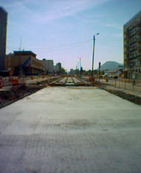
Etoile, Seyssinet 2003
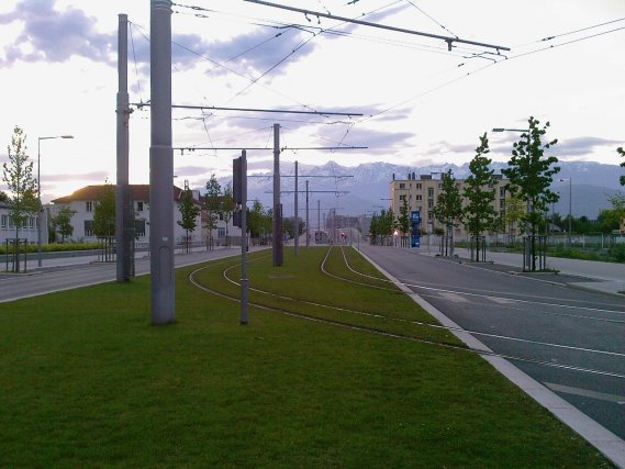
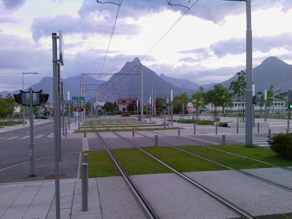
Etoile, Seyssinet 2009Although taken on a Sunday, this is normally a busy artery and connector system; its name "Etoile" implies it's a star shape, a collecting point for traffic coming into Grenoble from the south, namely Valence, via the Route National, as well as commuters coming down from the Vercors Massif or from surrounding communities heading across the bridge that spans the "Rocade Sud" peripheral road and the river Drac. And in spite of this fact, or perhaps because of it, local transport authorities opted for the construction of a 3rd tram line to link the southern side of Grenoble to the universities across town to the north.
View of the Etoile interchange and the bridge from Le Tour sans Venin (Vercors massif), 800 metres
above Fontaine, during construction of the TramwayAs previously mentioned, it's a normally busy place, but the authorities decided that Grenoble's third tram line should come through here, and the resulting effect on the traffic was very disruptive,with tens of thousands of vehicles going round or through Grenoble every day.
What you have to remember, though, is that Grenoble is circled by mountains and massifs, and until such time as the local authorities decide to build the much-discussed northern peripheral, with the tunnel under the Bastille, it's not going to get any better.This isn't downtown New York or Shinjuku in Tokyo, and before, everybody just went happily north, south, left and right with relative ease and Gallic impassivity until the tram line came. As if to respond to, or to anticipate, traffic requirements, some malicious urban planning architect decided to make it just a little more efficient by having certain roads double round on themselves to avoid the queues at lights from getting too long, throwing out the traffic light sequencing and blocking crossings with stranded cars that shot their respective traffic lights.
The French don't seem to want to stop on orange, and if they can get away with it, they won't always stop at red either, which, occasionally, leaves them stranded in the middle of a crossing, blocking the others going in the cross/other direction. And as if that wasn't enough, here comes a tram with its electronic device that switches the traffic lights in their favour and lets them sail across in front of you just as you were shifting down to 2nd gear to cross that light before it turned red.
NB. In 2009 I read that the French transport ministry was planning to install radar cameras at certain traffic lights, starting with Paris, to try and stem the number of infractions and accidents resulting from people shooting traffic lights.
Thinking at the time that it would certainly take time before they got installed in small provincial cities like Grenoble, it seems that, in an effort to refloat an ailing economy by any means, not quite 2 years after the announcement was made, the local "communist"-run council decided to go ahead and install one such camera on the corner of one particularly accident-prone street corner near where I live.
My surprise was moderate, my Schadenfreude undisguised when driving up to the local hypermarket one November day in 2011, a vehicle, 2 cars up from me, got flashed sailing serenely through the red lights... The joke I learnt just after I arrived in France about French drivers* seemed more than ever true: radars are for the others, never oneself, and we will see if this particular communist council sacrifices its own brand of ideology and aligns itself with the big brother Conservative central government in Paris in an effort to redress an economy in dire straits.
*... A girl is taking driving lessons in a small French provincial town, and the instructor comments on the relative ease with which the girl drives. The girl replies that it's because her uncle George had given her some lessons before. The instructor raises an eyebrow and is still thinking this over when the girl shoots through a first red light and then a second. The instructor asks her if she realises what she's done. "'Oh, yes",' she replies "...Uncle George said it's OK!'" as she promptly stops at a green light."'Why are you stopping at a green light, then?'" asks the nonplussed driving instructor. "'Uncle George may be coming the other way,'" replies the girl..
A winter's evening over Grenoble - Jan 2012
Meeting new challenges
Another effect of this is that all neighbouring communities, notably Fontaine, suffering from an increase in circulation, are now revising their policies and are seeking to reduce, but not ease, the volume of transitory traffic. What was once considered an obstacle, i.e., the mountains, is now being cultivated, mainly to incite visitors and tourists to come into the towns but hamper those just looking for a way to get around Grenoble as quickly as possible.
Towns like Fontaine now understand that instead of being perceived as desolate, windy dormitory towns that people prefer to drive through rather than stop in, they can offer a better environment for inhabitants and a place where visitors want to stop and shop. One of the first things Fontaine did was to break up the large rectilinear boulevards connecting the peripheral "Rocade Sud" to the National roads, implanting roundabouts, central islands and rockeries down the middle of the roads, grassing over the tramways, adding cycling lanes, widening the counter alleys running parallel to the boulevards, encouraging local traffic for shopping, and opening up new shops, cafes, cake shops and florists where before there were entrepots and garages.
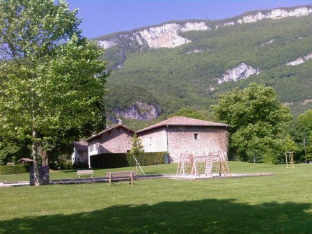
Neighbouring Sassenage, with its quaint old town centre and chateau that attract tourists, must have given Fontaine's city fathers something to think about. At the time of writing, Fontaine, after renovating its nature parks and river banks (see below), is now renovating old buildings of a certain architectural and historical value, long abandoned... a cultural counterbalance to the many social housing complexes Fontaine possesses.
Looking over Fontaine to the Chartreuse massif from the Vercors massifI occasionally walk up the mountain behind Fontaine to a local historical site called the "Tour Sans Venin" - or the Tower without Poison, a 45-minute walk, or rather a climb, up to the tower, situated at an altitude of ± 800 metres, and look down over Grenoble and across to the "Chartreuse" massif and across into the distance to the Belledonne mountain range.
You can also see the river Is�re joining the river Drac over the famous Grenoble Synchrotron facility to Mount Nero.
Mount Neron (1298m) - A trip around a mountain
I never actually learnt the name of this mountain until one warm, sunny but muggy summer Sunday afternoon, Sunday 03rd August 2003, to be exact, when, half dozing on the sofa after lunch, I remember turning my head, more out of instinct, to look out the little window by the front door to see lightning strike the mountain and hear the clap of thunder. I then spent the following three weeks, especially evenings after work, watching the mountain burn...but that's the story of another page in this website.
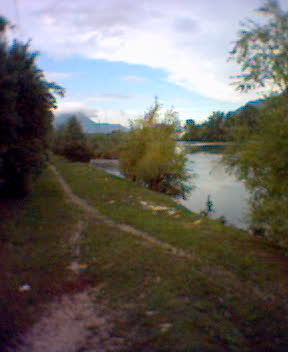
River Drac
Peaceful, isn't it? Not a soul in sight, and if you take things on appearance, you wouldn't think that there is a motorway just across the river and, just beyond that, some of Europe's most important scientific research, particle accelerators, atomic reactors and nanotechnology facilities included.
Since these photos were taken, the local authorities have made the Fontaine side of the river Drac more accessible to the inhabitants of Grenoble and neighbouring communities. They cut down trees that once bordered the river and laid down cycle paths and grassy walks. They stopped short of opening up access to the water because the river Drac isn't the cleanest, and subject to sudden surges of water when the French electricity company EDF opens their hydro dams further upstream in the mountains.
Disasters: Manmade or natural. If the risk of nuclear disasters from across the river wasn't enough, further upriver is a town called "Claix", where some of the most important chemical platforms in Southern France are situated. As if that wasn't enough, some way further upstream again, situated on a river called the "Romanche", a tributary of the River Drac that runs through Fontaine, is a community called Séchilienne.
The community is unique due to the fact it is located in a deep mountain gorge. In 2006, a significant portion of the mountainside collapsed into the valley below, forcing the village of the same name to evacuate.
La Poya Park
One of the surprises of Fontaine, and more proof of how little I knew the town I've lived in for a while now, is tucked away behind a dismal industrial zone, called the Vouillants, near the cemetery. It's a park called the "La Poya Nature Park" and to be honest, for all the time I've lived in Fontaine, I am not sure how long the park has been there, at least in its current shape and form. As I walked down from the cemetery one day, I mentioned to my wife that the side of the zone we were in had changed...gone were the 1960s-styled industrial buildings, garages and wholesale electrical stores, now replaced by 2000s-styled modular-type prefabricated composite buildings (old theme, new name...here today, gone in 10 years).y mother's generation would probably call them modern day Nissen huts*) housing Internet and Graphics startups.
* A little while ago, and literally 100 metres up the road from where I lived, the council built what appeared to be a modular cabin-type school annexe complex, since removed. Apparently, such "constructions" are nowadays just as safe and sound, not to mention more financially viable, as the permanent buildings.
But why not? I read that one school I went to, Pimlico School, Westminster, London, is going to be pulled down to make way for a construction more in line with modern day architecture. The school was "only" built in the late 1960s and was at the time considered "Avant-Garde" by the powers that be. Others tended to think of it as something out of " A Clockwork Orange", a soulless institution to mass educate a maximum number of students with maximum efficiency; the school kids of the time simply called it "Alcatraz". To be honest, thinking back to my school days in the 1970s, I just couldn't feel any sadness at its demise. Only there for two years, what good memories I have of the time spent there come from the school trips I went on, a cruise and skiing trips to Austria and Switzerland, a transitionary phase from the school I came from, Buckingham Gate, Westminster, and the one I went onto in Tavistock.
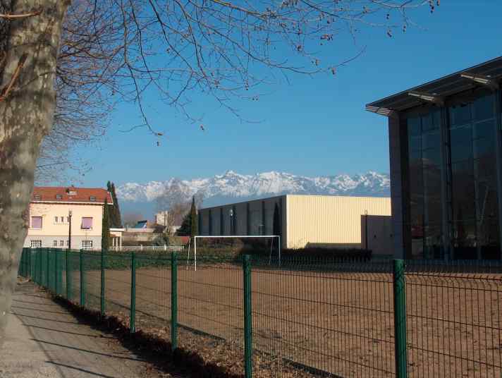
Fontaine's high school sports complex and as the song goes:
♪School gates remind me of my past♪
The "La Poya Nature Park" is comprised of several acres of green fields, trees and streams, not to mention man-made ponds and retainer basins (complete with croaking bullfrogs and ducks...that quack), but also an underwater spring source that bubbles up into a natural basin. So what's surprising about a park, this park? Well, like I said, for all the time I have lived in Fontaine, I never realised what it was and how close it was to our flat, my wife and I having the habit of going to Fontaine's other park, called the Karl Marx Park, where we went to take our post-wedding ceremony photos. The problem with the Karl Marx Park (the name makes my wife smile, her originating from that part of the world where Karl Marx had a particular influence) is that it's small and more an entry point to the mountains above and behind it, the starting point for several mountain hiking and cross-country cycle paths, than a particularly interesting destination point in itself for, say, daytime picnicking or sunbathing.
To be fair, though, it does have a number of exotic or foreign plant and tree species, including well-kept lawns and a lovely magnolia tree. It's a park where families, primarily mothers and grandmothers, with their heads covered or veiled, gather to spend the afternoon in the same location, around the toddlers' paddling pond. It goes without saying that sunbathing is discouraged, if not outright forbidden, given how quickly the afternoon sun sets behind the mountains at such an early hour.
On the contrary, only five minutes away from our apartment, the Nature Park "La Poya" was perfectly situated to spend a sunny summer Sunday, lazing under a chestnut tree or in a secluded corner out of immediate sight of the buildings at the entrance that house the local office of the "Alpine Workers Association", away from the heat of the flat, the noise of the neighbours stomping around above and the smell of cigarette smoke and female perfume odours wafting in through the open balcony windows from the flat below. Also, being slightly further away from the mountainside cliffs, the afternoon sun takes its time sliding behind the mountains, making the afternoon nap an extended relish.
Bigger and more secluded than its sister park, the "La Poya Nature Park" is less hemmed in by the cliffs of the here-not-so-near mountain, and the surroundings remind me of the park in Sassenage near where I used to live in a previous life, but the view is more open and more majestic. It's at times like that the extra-temporal pleasure is strongest, and it's at times like that I realise what, apart from my son, has kept me in the region for so long.
...
...
...
Sitting on a park bench near a little stream fed from a natural spring source, you would almost think you had left the town and were up on the nearby "Vercors" plateau, away from the hustle and bustle of the adjacent industrial zone and artery, boulevard Paul Langevin.
That being said, if my suspicion were to be confirmed, the adjacent boulevard will soon no longer be a wide and bustling, sinister thoroughfare for exceptional convoys and thousands of motorists and commercial vehicles heading for Grenoble via the Etoile, as it had been until now. No, the islands of grass, flowers and stones in the middle of the road now made it a smaller, less bustling, and perhaps slightly less sinister thoroughfare for the local inhabitants, leaving the heavy goods convoys and the thousands of motorists and commercial vehicles heading for Grenoble via the Etoile connector/interchange to find other routes and solutions.
One question still puzzled me. Where was the transitory traffic supposed to go? If they were to make this particular artery more restrictive, where would the traffic coming from places like Valence transit by in order to circumnavigate Grenoble without using the already choking Rocade Sud? The way things were going, the much-discussed and disputed Rocade Nord, with its tunnel under the Bastille, may never see the light of day! I'm curious to know what Fontaine town council really had in mind when they thought that one up.
© N.Richards 02/2004, updated January, 2012